


MARS BIBLE — PEOPLE
John Grotzinger
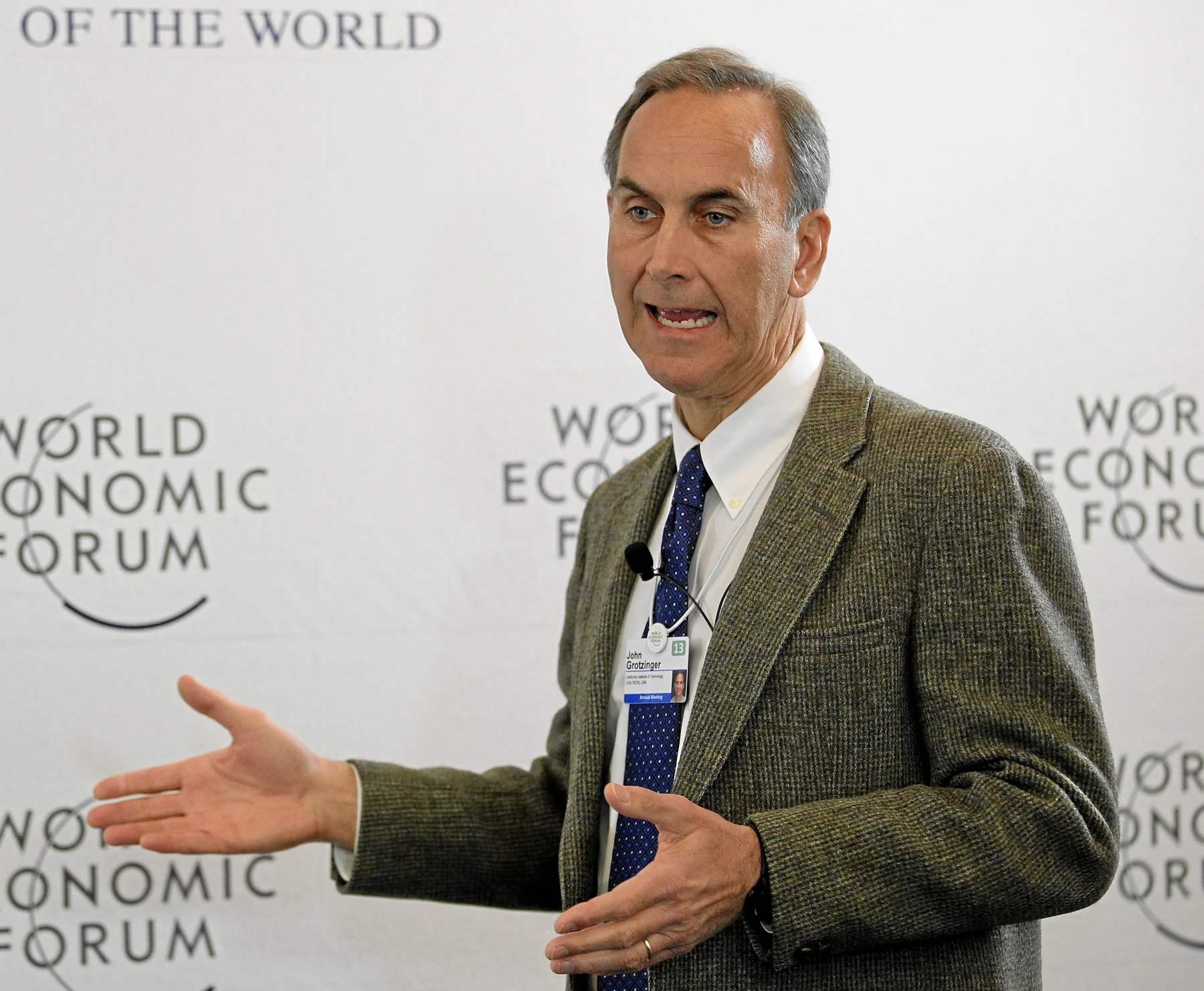
John Grotzinger's documented nationality or citizenship is American; the documented birthplace is Not stated in the cited Caltech CV. John Grotzinger is one of the geologists who taught Mars exploration to read the planet as a field archive. Trained on ancient terrestrial rocks, he progressively applied stratigraphy, sedimentology and geochemistry to Mars before becoming Curiosity’s project scientist. His career matters because it explains why a rover is more than a mobile machine: it is a robotic geologist whose route must reconstruct environmental history and test whether past conditions could have been habitable.
Chronological biography
1979–2005 — Field geology, stratigraphy and learning to read deep time
1979–2005: learning to read time in terrestrial rocks. John Grotzinger earned a B.S. in geology from Hobart College in 1979, an M.S. from the University of Montana in 1981, and a Ph.D. in geology from Virginia Tech in 1985. He then worked at the Geological Survey of Canada and Lamont-Doherty, became a professor at MIT, and joined Caltech in 2005. His expertise developed around sedimentology, stratigraphy, and geobiology: reconstructing ancient environments from the physical record preserved in rocks. Caltech — John Grotzinger CV Source.
Before Curiosity, Grotzinger learned his craft in ancient terrestrial rocks. Stratigraphy taught him to reason about sequences, environments and durations that are never observed directly: the geologist reconstructs history from incomplete evidence. That skill became extraordinarily powerful on Mars. Once rovers began returning panoramas, mineral analyses and chemistry, he could treat their observations like a field campaign. His career shows how an old discipline—the reading of layers—became one of the central tools of a modern robotic mission. Institutional source.
Before Curiosity, then, he was fundamentally a field geologist trained to extract history from deposits, sedimentary structures, and stratigraphic relationships. Mars became especially powerful because a rover could apply part of that method on another world, provided instruments and operations were designed as an extension of geological fieldwork rather than as isolated experiments.
John Grotzinger studied geology at Hobart College, the University of Montana and Virginia Tech. Before Mars, his career centred on sedimentology, stratigraphy and geobiology. He worked at the Geological Survey of Canada and Lamont-Doherty, became a professor at MIT and later joined Caltech. Those steps taught him to read a rock not as an isolated object but as part of an environmental history. Source
That discipline is fundamental on Mars. A sedimentary layer only gains meaning from its position, texture, cross-cutting structures and neighbouring units. The future Curiosity project scientist therefore arrived with a culture in which scientific observation is inseparable from context. A rover had to be operated like a very slow field geologist supported by a large team.
A field geologist before becoming a Mars mission leader. From terrestrial field geology to Gale: reconstructing the environmental history of Mars. John P. Grotzinger is an American geologist and the Harold Brown Professor of Geology at Caltech. The institutional Caltech CV consulted does not state his date of birth, so this page records that item as undocumented rather than inferring a year from secondary sources. His CV records a B.S. from Hobart College in 1979, an M.S. from the University of Montana in 1981 and a Ph.D. from Virginia Tech in 1985. Long before Curiosity, his field sites were on Earth: sedimentary basins, carbonate systems and Precambrian records of interactions among oceans, atmosphere and life. That background matters because a rover never observes an ancient climate directly. It observes rocks, grains, layers, minerals and geometries from which a history must be reconstructed.
His approach therefore treats Mars as a real geological field area rather than a collection of attractive images. A tilted bed, erosional surface, conglomerate or mudstone succession becomes meaningful only when placed in sequence. That is the essence of stratigraphy: determining order, relationships and intervening events. For habitability research, this discipline is essential because a water-related mineral means something different if it formed in a long-lived lake, a brief event or a later alteration process.
Connecting orbital maps with rover-scale geology. Before leading Curiosity science, Grotzinger participated in the Mars Exploration Rover missions and the HiRISE camera team on Mars Reconnaissance Orbiter. Combining orbital and surface views is one of the defining strengths of modern Mars exploration. An orbiter provides regional context and candidate units; a rover supplies texture, chemistry and stratigraphy at field scale. The two datasets do not automatically tell the same story, and scientific progress depends on linking the scales without forcing them to agree.
That approach prepared the exploration of Gale crater. From orbit, the central mound shows a thick succession of layered material. On the ground, Curiosity can test what those layers actually record. The scientific journey is therefore not simply a climb toward a summit; it is a progressive reading of an archive. Every traverse balances the desire to reach the next unit against the risk of leaving a unique exposure insufficiently documented. The same tension between coverage and depth will confront future human field teams.
Mars Science Laboratory leadership: science and engineering as one operational system. Caltech’s CV lists Grotzinger as Chief Scientist of the Mars Science Laboratory rover from 2006 to 2015. That role begins long before landing. Objectives must be translated into instrument choices, vehicle constraints, operational rules and the practices of a large international science team. In planetary exploration, the most interesting scientific question is not always the question the rover can safely address today. It has to be converted into sequences, power, data volume, arm geometry, driving risk and available time.
Grotzinger has described the job as overseeing the interface between the science and engineering teams. This is a major Mars lesson: science is not a passenger carried by engineering; the two systems are co-designed. A human base will face the same problem on a larger scale. Geologists will want field time, operators will protect vehicles, physicians will manage exposure and power teams will defend margins. The settlement will need governance that can turn competing objectives into executable, documented plans.
Yellowknife Bay and the exact meaning of habitability. One of Curiosity’s foundational results during Grotzinger’s science leadership was evidence that Yellowknife Bay recorded an ancient environment compatible with microbial habitability. The term “habitable” does not mean “inhabited.” It means that several physical and chemical conditions known to support life were available, including past liquid water and suitable chemical ingredients and energy sources. Keeping that distinction explicit is essential in every discussion of possible Martian life.
The result also changed the mission’s intellectual trajectory. Once Gale crater was shown to preserve potentially habitable environments, the scientific question could expand from whether Mars was ever wet to how long favorable environments lasted, how diverse they were and how they changed. Stratigraphy again becomes central: each layer may record part of the transition from an ancient, more active Mars toward the cold and arid planet observed today.
A method for geologists in a future settlement. Humans on Mars will be able to inspect outcrops far more quickly than a rover, but speed creates its own risk: observations can accumulate without a shared context. Field-geology discipline will remain essential. Recording units, orientations, contacts, grain sizes, sedimentary structures, mineralogy and the exact position of samples allows another crew to reconstruct the interpretation later.
Grotzinger’s importance in the history of Mars lies in the transition from broadly searching for signs of water to doing stratigraphic geology capable of reconstructing successive environments. A scientific settlement will need to institutionalize that rigor through mapping, nomenclature, archives, sampling standards, documented disagreement and the willingness to revise a model when new layers or analyses contradict the first story.
MSL: becoming project scientist before the rover reached Mars. Grotzinger led the science of Mars Science Laboratory while the vehicle was still in development. The job was not simply to choose interesting questions. It required learning engineering constraints, understanding what instruments could actually do, resolving competing priorities and building an organisation capable of daily decisions after landing. Source
This phase reveals an often invisible profession: translating a scientific question into operations. A hypothesis about an ancient lake may require imaging, chemistry, drilling and multiple sols. Every step consumes time, energy and hardware life. The project scientist protects intellectual coherence while accepting vehicle constraints.
2006–2015 — Curiosity: turning geology into mission organization
2006–2015: Curiosity, when field geology becomes mission organization. Grotzinger became Mars Science Laboratory project scientist while the rover’s instruments were still being developed. He had to learn how to connect a science team to an engineering team, follow testing and reviews, and see instruments certified for flight. After landing, evidence for ancient lake environments and habitable conditions in Gale crater turned that preparation into genuine robotic field geology. Caltech — Mars Science Laboratory interview Source.
After landing, Curiosity encountered sedimentary rocks at Yellowknife Bay associated with an ancient lake environment. The team showed that several conditions compatible with microbial habitability had existed, including liquid water and usable chemical ingredients. The distinction remained crucial: habitable does not mean inhabited. Source
Grotzinger helped establish a Mars method that begins by reconstructing environment rather than chasing a spectacular conclusion. Human geologists will need the same discipline. They can collect faster than a rover, but speed must not destroy the stratigraphic context that gives an individual sample scientific meaning.
Gale — Reading environmental history with the tools of a field geologist
Reading Mars with the tools of field geology. John Grotzinger built much of his career around sedimentology, stratigraphy and geobiology. That background is central to understanding his role in Mars exploration. Sedimentary rocks are not merely materials; they record how particles were transported, deposited, cemented and later modified. On Earth, those archives allow geologists to reconstruct seas, lakes, rivers, microbial environments and climate change. Applying the same discipline to Mars means asking not only whether water-related minerals are present, but what environment could have produced them and how that environment changed through time. Source.
Before and during the Mars Science Laboratory mission, Grotzinger brought that style of reading rock sequences to Curiosity. The rover was sent to Gale crater with habitability questions and at Yellowknife Bay encountered sedimentary rocks that supported reconstruction of an ancient lake environment. The major result was not proof of life. It was evidence that an ancient environment combined several conditions compatible with microbial habitability: liquid water, useful chemical elements, potential energy sources and conditions that were not necessarily extreme for microorganisms. [source]
This approach requires preserving relationships among observations. A layer only makes sense relative to what lies below, above and beside it. Interesting chemistry has different significance in a lake deposit, a later vein or reworked material. For a future crewed mission, that means geologists cannot simply collect samples. They will have to document structures, orientations, contacts, textures and context before removing material, just as in terrestrial field geology but under far tighter time and safety constraints. [source]
Leading Curiosity: building a shared question rather than a list of instruments. A project scientist has to prevent a large mission from becoming a set of instruments pursuing disconnected priorities. Curiosity carries cameras, spectrometers, chemical instruments, atmospheric sensors and drilling capability. The challenge is to organize those tools around common questions. Grotzinger held that role through mission development and the early surface campaign before Ashwin Vasavada succeeded him. The experience shows that scientific architecture needs intellectual governance: deciding what counts as sufficient evidence, when to investigate more deeply, when to move on and how to make different datasets converge. [source]
His Earth and Mars work also shows how to use analogies carefully. Terrestrial environments provide process models, but they cannot simply be treated as copies of Mars. Gravity, pressure, atmospheric chemistry, thermal history and process duration differ. An analog should produce a testable hypothesis, not a declaration that two similar-looking landscapes must share the same history. That discipline is equally important for settlement engineering, where geological, hydrological or biological methods imported from Earth must be requalified for Martian conditions. [source]
Grotzinger also connects the search for life to environments rather than to a spectacular search for an organism. A mature strategy first identifies where and when habitable conditions may have existed, which processes preserve evidence and which materials deserve deeper analysis. That hierarchy maps directly onto a Mars base: survey, characterize, select, document, sample and analyze, while preserving a complete data history so that earlier decisions can be revisited. [source]
Grotzinger’s work on Curiosity also demonstrates why a project scientist is not simply the person who chooses the most interesting rock. The role is an interface: geology, instrument capabilities, rover safety, sequencing, communications and limited mission time all meet in the same daily decision. A field geologist learns to change a hypothesis when the outcrop disagrees; a rover project scientist has to make that same intellectual flexibility work through hundreds of specialists and a machine on another planet. [source]
Gale crater turned that method into a long-form investigation. Stratigraphy lets the team ask not only what minerals exist, but in what order environments changed and which processes produced the observed layers. That temporal reasoning is what makes the site useful for habitability questions. The biography is stronger when Curiosity is read as an extension of Grotzinger’s geological training rather than as a sudden appointment detached from the decades before it. [source]
Supplementary documentary analysis
Biographical analysis, context and legacy
Thematic analysis and deeper reading
Essential timeline
- PeriodCuriosity project scientist 2007–2014
- MarsCuriosity and Gale crater
- LegacyHabitability and sedimentary archives
Deep reading: what this trajectory teaches
From Philadelphia to geological fieldwork
John Grotzinger’s academic path is that of a geologist before that of a mission scientist: a 1979 geology degree from Hobart College, an MS from the University of Montana in 1981 and a Virginia Tech PhD in 1985. His CV then records work with the Geological Survey of Canada and Lamont-Doherty, a long MIT career and a move to Caltech in 2005. 1
That background explains his particular way of reading Mars. Field geology trains a scientist to reconstruct vanished environments from incomplete outcrops, sedimentary geometry, mineral assemblages and stratigraphic relationships. A rover therefore becomes less a camera-equipped robot than a displaced field geologist whose team must decide where context is strong enough to justify drilling, which contact between units matters and when it is scientifically responsible to leave a site.
John Grotzinger trained first as a geologist: Hobart College, the University of Montana and a Ph.D. at Virginia Tech in 1985. His scientific identity did not begin in spaceflight but in sedimentary rocks, basins and deep time. That origin matters because when he later worked on Mars he did not begin with spectacular imagery; he looked for relationships among layers, textures, minerals and depositional geometry that could reconstruct an ancient environment. [source] [source]
In the chapter “From Philadelphia to geological fieldwork,” this framework forces a check between the precise historical fact, the scientific question actually being asked and the constraints specific to that stage of the career.
In the career of this stratigrapher and geobiologist, “From Philadelphia to geological fieldwork” provides a comparison with earlier stages.
For “From Philadelphia to geological fieldwork,” the Mars application should therefore be stated as a specific reduction of uncertainty rather than a general promise of settlement.
As a teaching case, “From Philadelphia to geological fieldwork” also separates three levels that are often blurred together: the observed or documented fact, the scientific interpretation that gives it meaning, and the operational decision made from that interpretation.
In “From Philadelphia to geological fieldwork,” that boundary is intentionally part of the result: it states what this stage supports and what it still leaves open.
Geological Survey of Canada and Lamont: learning large terrains
After his doctorate, Grotzinger worked with the Geological Survey of Canada and at Lamont-Doherty. Large North American field areas taught him a form of geology in which observations are sparse, incomplete and assembled into regional history. That intellectual discipline resembles planetary geology: no dataset is complete, outcrops must be ranked by information value, local relations must be separated from regional signals, and a scientist must recognize when an interpretation remains underdetermined. [source]
What matters is not only what worked. That vulnerability makes the episode instructive. In the chapter “Geological Survey of Canada and Lamont: learning large terrains,” this framework forces a check between the precise historical fact, the scientific question actually being asked and the constraints specific to that stage of the career.
The chapter “Geological Survey of Canada and Lamont: learning large terrains” also shows that the work of a stratigrapher and geobiologist is collective by construction.
For “Geological Survey of Canada and Lamont: learning large terrains,” the Mars application should therefore be stated as a specific reduction of uncertainty rather than a general promise of settlement.
As a teaching case, “Geological Survey of Canada and Lamont: learning large terrains” also separates three levels that are often blurred together: the observed or documented fact, the scientific interpretation that gives it meaning, and the operational decision made from that interpretation.
In “Geological Survey of Canada and Lamont: learning large terrains,” that boundary is intentionally part of the result: it states what this stage supports and what it still leaves open.
MIT: early Earth as a laboratory
Beginning in 1988, Grotzinger built an MIT career around ancient Earth environments. He worked on sedimentology, stratigraphy and geobiology, including the chemistry of early oceans and atmosphere and the environmental context of biological evolution. Mars gradually entered that framework through comparison—not because early Earth is a duplicate of Mars, but because the same tools allow scientists to ask how an environment leaves an archive in rock. [source] [source]
In the chapter “MIT: early Earth as a laboratory,” this framework forces a check between the precise historical fact, the scientific question actually being asked and the constraints specific to that stage of the career.
To understand “MIT: early Earth as a laboratory,” the full chain matters more than one headline result. The stratigrapher and geobiologist works inside a system where a schedule decision can change an observation, an instrument limit can redefine the testable hypothesis, and the documentation of an anomaly can matter as much as nominal success.
For “MIT: early Earth as a laboratory,” the Mars application should therefore be stated as a specific reduction of uncertainty rather than a general promise of settlement.
As a teaching case, “MIT: early Earth as a laboratory” also separates three levels that are often blurred together: the observed or documented fact, the scientific interpretation that gives it meaning, and the operational decision made from that interpretation.
In “MIT: early Earth as a laboratory,” that boundary is intentionally part of the result: it states what this stage supports and what it still leaves open.
Namibia, Siberia and southern Africa: learning to read deep time
Grotzinger's field projects span Canada, Siberia, southern Africa and other regions where ancient sedimentary successions preserve climatic, chemical and biological episodes far removed from the modern world. The practice is to map the stratigraphic framework before interpreting a geochemical or paleontological signal. That principle became crucial with Curiosity: an isolated chemical measurement has far less value if its layer, sedimentary setting and relation to surrounding units are poorly constrained. [source] [source]
Every observation has an opportunity cost. In the chapter “Namibia, Siberia and southern Africa: learning to read deep time,” this framework forces a check between the precise historical fact, the scientific question actually being asked and the constraints specific to that stage of the career.
At this stage, “Namibia, Siberia and southern Africa: learning to read deep time” reveals how experience changes judgment. The stratigrapher and geobiologist never has perfect information; the skill is learning which uncertainties can be tolerated, which require another measurement and which should stop a sequence.
For “Namibia, Siberia and southern Africa: learning to read deep time,” the Mars application should therefore be stated as a specific reduction of uncertainty rather than a general promise of settlement.
As a teaching case, “Namibia, Siberia and southern Africa: learning to read deep time” also separates three levels that are often blurred together: the observed or documented fact, the scientific interpretation that gives it meaning, and the operational decision made from that interpretation.
In “Namibia, Siberia and southern Africa: learning to read deep time,” that boundary is intentionally part of the result: it states what this stage supports and what it still leaves open.
Entering Mars exploration through geology, not rockets
Grotzinger joined the Mars Exploration Rovers as a participating scientist and also worked with HiRISE. He therefore entered spaceflight through a mature scientific question: how to distinguish sedimentary environments, recognize the action of water and reconstruct sequences of events. Entering mission culture from field geology required translating familiar actions—choosing a section, changing scale, comparing facies—into commands that could be executed by a robot and a distributed science team. [source] [source]
In the chapter “Entering Mars exploration through geology, not rockets,” this framework forces a check between the precise historical fact, the scientific question actually being asked and the constraints specific to that stage of the career.
In the career of this stratigrapher and geobiologist, “Entering Mars exploration through geology, not rockets” provides a comparison with earlier stages.
For “Entering Mars exploration through geology, not rockets,” the Mars application should therefore be stated as a specific reduction of uncertainty rather than a general promise of settlement.
As a teaching case, “Entering Mars exploration through geology, not rockets” also separates three levels that are often blurred together: the observed or documented fact, the scientific interpretation that gives it meaning, and the operational decision made from that interpretation.
In “Entering Mars exploration through geology, not rockets,” that boundary is intentionally part of the result: it states what this stage supports and what it still leaves open.
Caltech and Mars Science Laboratory: moving into project responsibility
Grotzinger’s CV lists him as Mars Science Laboratory chief/project scientist from 2006 to 2015. During that period the difficulty was no longer simply to conduct first-rate geology; it was to make a large scientific community operate at the cadence of an interplanetary vehicle. 2
After Curiosity landed in 2012, scientific intent had to be converted daily into executable sequences: imaging, driving, remote spectroscopy, brushing, drilling and sample delivery. The project scientist did not personally own every choice. Grotzinger’s responsibility was to keep a coherent geological argument across instrument teams, rover planners, engineers and specialists who could never stand on the outcrop themselves.
Grotzinger joined Caltech in 2005 and became Mars Science Laboratory project scientist beginning in 2007. The role differed from that of an individual researcher. Mission objectives, instruments, landing-site selection, rover safety, disciplinary teams and publication strategy had to remain coherent. Science had to be planned years before the field site was directly known while retaining enough flexibility for the actual landing site to overturn orbital expectations. [source] [source]
What matters is not only what worked. That vulnerability makes the episode instructive. In the chapter “Caltech and Mars Science Laboratory: moving into project responsibility,” this framework forces a check between the precise historical fact, the scientific question actually being asked and the constraints specific to that stage of the career.
The chapter “Caltech and Mars Science Laboratory: moving into project responsibility” also shows that the work of a stratigrapher and geobiologist is collective by construction.
For “Caltech and Mars Science Laboratory: moving into project responsibility,” the Mars application should therefore be stated as a specific reduction of uncertainty rather than a general promise of settlement.
As a teaching case, “Caltech and Mars Science Laboratory: moving into project responsibility” also separates three levels that are often blurred together: the observed or documented fact, the scientific interpretation that gives it meaning, and the operational decision made from that interpretation.
In “Caltech and Mars Science Laboratory: moving into project responsibility,” that boundary is intentionally part of the result: it states what this stage supports and what it still leaves open.
Why Gale: choosing an archive rather than a landscape
Gale Crater was selected because its central mound exposes kilometres of stratigraphy and mineral signatures consistent with changing aqueous environments. The choice was therefore not aesthetic; it maximized access to a climate archive. Grotzinger and the team nevertheless had to accept a compromise: the rover could not land directly on the lower slopes of Mount Sharp. Science at the landing ellipse had to be valuable in its own right before a long traverse toward the primary target. [source] [source]
In the chapter “Why Gale: choosing an archive rather than a landscape,” this framework forces a check between the precise historical fact, the scientific question actually being asked and the constraints specific to that stage of the career.
To understand “Why Gale: choosing an archive rather than a landscape,” the full chain matters more than one headline result. The stratigrapher and geobiologist works inside a system where a schedule decision can change an observation, an instrument limit can redefine the testable hypothesis, and the documentation of an anomaly can matter as much as nominal success.
For “Why Gale: choosing an archive rather than a landscape,” the Mars application should therefore be stated as a specific reduction of uncertainty rather than a general promise of settlement.
As a teaching case, “Why Gale: choosing an archive rather than a landscape” also separates three levels that are often blurred together: the observed or documented fact, the scientific interpretation that gives it meaning, and the operational decision made from that interpretation.
In “Why Gale: choosing an archive rather than a landscape,” that boundary is intentionally part of the result: it states what this stage supports and what it still leaves open.
A rolling laboratory after seven minutes of terror
Curiosity reached Mars in August 2012 with far greater mass and complexity than the MER rovers. The sky crane belonged to the engineering project, but the project scientist had to prepare what happened after wheels touched the ground: checkouts, environmental measurements, target selection and a balance between the desire to reach Mount Sharp and the risk of moving too quickly through unknown terrain. Martian field geology begins with operational patience. [source] [source]
Every observation has an opportunity cost. In the chapter “A rolling laboratory after seven minutes of terror,” this framework forces a check between the precise historical fact, the scientific question actually being asked and the constraints specific to that stage of the career.
At this stage, “A rolling laboratory after seven minutes of terror” reveals how experience changes judgment. The stratigrapher and geobiologist never has perfect information; the skill is learning which uncertainties can be tolerated, which require another measurement and which should stop a sequence.
For “A rolling laboratory after seven minutes of terror,” the Mars application should therefore be stated as a specific reduction of uncertainty rather than a general promise of settlement.
As a teaching case, “A rolling laboratory after seven minutes of terror” also separates three levels that are often blurred together: the observed or documented fact, the scientific interpretation that gives it meaning, and the operational decision made from that interpretation.
In “A rolling laboratory after seven minutes of terror,” that boundary is intentionally part of the result: it states what this stage supports and what it still leaves open.
Yellowknife Bay: drill before climbing
Yellowknife Bay became a defining example. Curiosity identified an ancient fluvial-lacustrine system and chemistry compatible with an environment that could have supplied key requirements for microbial life, had life originated there. Caltech highlighted the ancient lake system and its potential for chemolithotrophic habitability among the major findings of Grotzinger’s project-scientist period. 3
The biographical point lies in the route to that result. The team could have treated Mount Sharp, visibly towering over the landing site, as the destination to reach as quickly as possible. Instead it invested time in a lower, less dramatic unit because the stratigraphy justified it. Future human field crews will have greater mobility, but the same intellectual discipline will remain: spectacular distance travelled is not a substitute for geological context.
The decision to send Curiosity into Yellowknife Bay before the long drive to Mount Sharp became one of the mission's most productive choices. The terrain showed conglomerates, veins and mudstones; the first drill produced gray powder revealing chemistry far less oxidized than the red surface dust. Clay minerals, essential elements and redox couples supported the conclusion that an ancient lake environment could have sustained chemolithoautotrophic microbial metabolism had life existed there. [source] [source] [source]
In the chapter “Yellowknife Bay: drill before climbing,” this framework forces a check between the precise historical fact, the scientific question actually being asked and the constraints specific to that stage of the career.
In the career of this stratigrapher and geobiologist, “Yellowknife Bay: drill before climbing” provides a comparison with earlier stages.
For “Yellowknife Bay: drill before climbing,” the Mars application should therefore be stated as a specific reduction of uncertainty rather than a general promise of settlement.
As a teaching case, “Yellowknife Bay: drill before climbing” also separates three levels that are often blurred together: the observed or documented fact, the scientific interpretation that gives it meaning, and the operational decision made from that interpretation.
In “Yellowknife Bay: drill before climbing,” that boundary is intentionally part of the result: it states what this stage supports and what it still leaves open.
Habitability is not life detection
Grotzinger emphasized a distinction that structures modern Mars astrobiology: showing that an environment contained water, chemical ingredients, energy and tolerable conditions does not demonstrate that life was present. Yellowknife Bay first answered a habitability question. The search for organic carbon and taphonomy—the processes that destroy, transform or preserve evidence—then become essential for moving from 'this environment could have supported life' to 'this environment might have preserved a detectable record.' [source] [source]
What matters is not only what worked. That vulnerability makes the episode instructive. In the chapter “Habitability is not life detection,” this framework forces a check between the precise historical fact, the scientific question actually being asked and the constraints specific to that stage of the career.
The chapter “Habitability is not life detection” also shows that the work of a stratigrapher and geobiologist is collective by construction.
For “Habitability is not life detection,” the Mars application should therefore be stated as a specific reduction of uncertainty rather than a general promise of settlement.
As a teaching case, “Habitability is not life detection” also separates three levels that are often blurred together: the observed or documented fact, the scientific interpretation that gives it meaning, and the operational decision made from that interpretation.
In “Habitability is not life detection,” that boundary is intentionally part of the result: it states what this stage supports and what it still leaves open.
Mount Sharp: a mountain as a time series
On reaching the lower layers of Mount Sharp, Curiosity encountered alternating lake, river and wind deposits. Grotzinger helped turn topography into chronology: each layer is not merely a composition but a state of the Martian system. Repeated lake filling and transitions toward drier conditions show that climate history is not a single switch from wet Mars to desert Mars but a succession of environments, episodes and regimes recorded in sedimentary rock. [source] [source]
In the chapter “Mount Sharp: a mountain as a time series,” this framework forces a check between the precise historical fact, the scientific question actually being asked and the constraints specific to that stage of the career.
To understand “Mount Sharp: a mountain as a time series,” the full chain matters more than one headline result. The stratigrapher and geobiologist works inside a system where a schedule decision can change an observation, an instrument limit can redefine the testable hypothesis, and the documentation of an anomaly can matter as much as nominal success.
For “Mount Sharp: a mountain as a time series,” the Mars application should therefore be stated as a specific reduction of uncertainty rather than a general promise of settlement.
As a teaching case, “Mount Sharp: a mountain as a time series” also separates three levels that are often blurred together: the observed or documented fact, the scientific interpretation that gives it meaning, and the operational decision made from that interpretation.
In “Mount Sharp: a mountain as a time series,” that boundary is intentionally part of the result: it states what this stage supports and what it still leaves open.
Dating the terrain: connecting stratigraphy and geochronology
Curiosity also performed the first radiometric age measurement directly on a Martian rock. For a stratigrapher such as Grotzinger, the value is not to replace relative chronology but to calibrate it. A layer has a depositional age, may experience later diagenesis, fractures and alteration, and can eventually be exposed by erosion. Separating those stages prevents confusion among the age of a mineral, the age of a habitable environment and the time when a surface became exposed to cosmic radiation. [source]
Every observation has an opportunity cost. In the chapter “Dating the terrain: connecting stratigraphy and geochronology,” this framework forces a check between the precise historical fact, the scientific question actually being asked and the constraints specific to that stage of the career.
At this stage, “Dating the terrain: connecting stratigraphy and geochronology” reveals how experience changes judgment. The stratigrapher and geobiologist never has perfect information; the skill is learning which uncertainties can be tolerated, which require another measurement and which should stop a sequence.
For “Dating the terrain: connecting stratigraphy and geochronology,” the Mars application should therefore be stated as a specific reduction of uncertainty rather than a general promise of settlement.
As a teaching case, “Dating the terrain: connecting stratigraphy and geochronology” also separates three levels that are often blurred together: the observed or documented fact, the scientific interpretation that gives it meaning, and the operational decision made from that interpretation.
In “Dating the terrain: connecting stratigraphy and geochronology,” that boundary is intentionally part of the result: it states what this stage supports and what it still leaves open.
2015: leaving the role without leaving Mars
In January 2015 Grotzinger handed the project-scientist role to Ashwin Vasavada while remaining engaged with Mars and taking on broader Caltech leadership. Caltech noted that he had led MSL science since 2007 and had previously worked with both the Mars Exploration Rovers and Mars Reconnaissance Orbiter. 4
What he transmitted was therefore not a single instrument or engineering design but a practice: connect terrestrial field reasoning to robotic field operations. His group continues to study early environments on both Earth and Mars, allowing rover observations to be tested against a lifetime of work on sedimentary archives that can actually be touched, mapped and sampled on Earth.
In 2015 Grotzinger stepped down as project scientist and Ashwin Vasavada took over as he became chair of Caltech's Geological and Planetary Sciences division. The transition matters because a healthy mission must survive its original science leader. He remained a Curiosity team member and continued research, but institutional continuity requires decision rules, data practices, methods and scientific culture that can be transferred rather than residing in one person. [source] [source]
In the chapter “2015: leaving the role without leaving Mars,” this framework forces a check between the precise historical fact, the scientific question actually being asked and the constraints specific to that stage of the career.
In the career of this stratigrapher and geobiologist, “2015: leaving the role without leaving Mars” provides a comparison with earlier stages.
For “2015: leaving the role without leaving Mars,” the Mars application should therefore be stated as a specific reduction of uncertainty rather than a general promise of settlement.
As a teaching case, “2015: leaving the role without leaving Mars” also separates three levels that are often blurred together: the observed or documented fact, the scientific interpretation that gives it meaning, and the operational decision made from that interpretation.
In “2015: leaving the role without leaving Mars,” that boundary is intentionally part of the result: it states what this stage supports and what it still leaves open.
Mars 2020: from Gale to Jezero, comparing two sedimentary archives
Grotzinger also participates in Mars 2020. Jezero provides a different archive from Gale: an orbital-scale delta, carbonate-bearing units and an explicit objective of collecting samples for possible analysis on Earth. Curiosity experience enables a more demanding question: not only which environment was habitable, but which rock has the best chance of preserving a biosignature and remaining interpretable years later in a laboratory that never directly observed the Martian outcrop. [source] [source]
What matters is not only what worked. That vulnerability makes the episode instructive. In the chapter “Mars 2020: from Gale to Jezero, comparing two sedimentary archives,” this framework forces a check between the precise historical fact, the scientific question actually being asked and the constraints specific to that stage of the career.
The chapter “Mars 2020: from Gale to Jezero, comparing two sedimentary archives” also shows that the work of a stratigrapher and geobiologist is collective by construction.
For “Mars 2020: from Gale to Jezero, comparing two sedimentary archives,” the Mars application should therefore be stated as a specific reduction of uncertainty rather than a general promise of settlement.
As a teaching case, “Mars 2020: from Gale to Jezero, comparing two sedimentary archives” also separates three levels that are often blurred together: the observed or documented fact, the scientific interpretation that gives it meaning, and the operational decision made from that interpretation.
In “Mars 2020: from Gale to Jezero, comparing two sedimentary archives,” that boundary is intentionally part of the result: it states what this stage supports and what it still leaves open.
Remote geology: building context before the sample
A human Mars mission would finally place geologists who can touch, turn and break rocks on the surface, but EVA time, carrying capacity and safety would remain limited. Grotzinger's legacy is therefore concrete: build context before sampling. Map the site, document layer relations, preserve coordinates, image multiple scales and record why the sample was selected. Without that discipline, an extraordinary specimen can become scientifically ambiguous once removed from its field setting. [source] [source]
In the chapter “Remote geology: building context before the sample,” this framework forces a check between the precise historical fact, the scientific question actually being asked and the constraints specific to that stage of the career.
To understand “Remote geology: building context before the sample,” the full chain matters more than one headline result. The stratigrapher and geobiologist works inside a system where a schedule decision can change an observation, an instrument limit can redefine the testable hypothesis, and the documentation of an anomaly can matter as much as nominal success.
For “Remote geology: building context before the sample,” the Mars application should therefore be stated as a specific reduction of uncertainty rather than a general promise of settlement.
As a teaching case, “Remote geology: building context before the sample” also separates three levels that are often blurred together: the observed or documented fact, the scientific interpretation that gives it meaning, and the operational decision made from that interpretation.
In “Remote geology: building context before the sample,” that boundary is intentionally part of the result: it states what this stage supports and what it still leaves open.
The professor and the long duration
Grotzinger's career remains divided among administration, missions and the training of students who work on both Earth and Mars. His group studies ancient and modern systems, from microbial mats to carbonates, with the same requirement: understand processes before reaching for dramatic analogy. That attitude also protects Mars studies from a common temptation—calling every red or arid landscape a 'Mars analog.' An analog is useful only for a defined variable and within a domain where the differences are explicitly understood. [source] [source]
Every observation has an opportunity cost. In the chapter “The professor and the long duration,” this framework forces a check between the precise historical fact, the scientific question actually being asked and the constraints specific to that stage of the career.
At this stage, “The professor and the long duration” reveals how experience changes judgment. The stratigrapher and geobiologist never has perfect information; the skill is learning which uncertainties can be tolerated, which require another measurement and which should stop a sequence.
For “The professor and the long duration,” the Mars application should therefore be stated as a specific reduction of uncertainty rather than a general promise of settlement.
As a teaching case, “The professor and the long duration” also separates three levels that are often blurred together: the observed or documented fact, the scientific interpretation that gives it meaning, and the operational decision made from that interpretation.
In “The professor and the long duration,” that boundary is intentionally part of the result: it states what this stage supports and what it still leaves open.
Primary and institutional sources
- Caltech — Grotzinger steps down as Curiosity project scientist
- John Grotzinger — Mars Research, Caltech
- JPL — Blogs by John Grotzinger
- JPL — Curiosity clues to ancient lakes
- Caltech — John Grotzinger CV
- Caltech — John Grotzinger homepage
- American Academy of Arts and Sciences — John P. Grotzinger
- NASA Science — John Grotzinger profile
- Caltech — John Grotzinger homepage
- Caltech — John Grotzinger curriculum vitae
- Caltech — Mars research and Curiosity
- JPL — Habitability, taphonomy and Curiosity’s hunt for organic carbon
- JPL — Curiosity explores Yellowknife Bay
- JPL — Curiosity finds conditions once suited for ancient life
- Caltech — Grotzinger steps down as Curiosity project scientist
- Science/Caltech — A habitable fluvio-lacustrine environment at Yellowknife Bay
- NASA — Curiosity clues to how water shaped the Martian landscape
- JPL — Curiosity first Mars age measurement and human exploration help
- NASA Astrobiology — Mars Science Laboratory