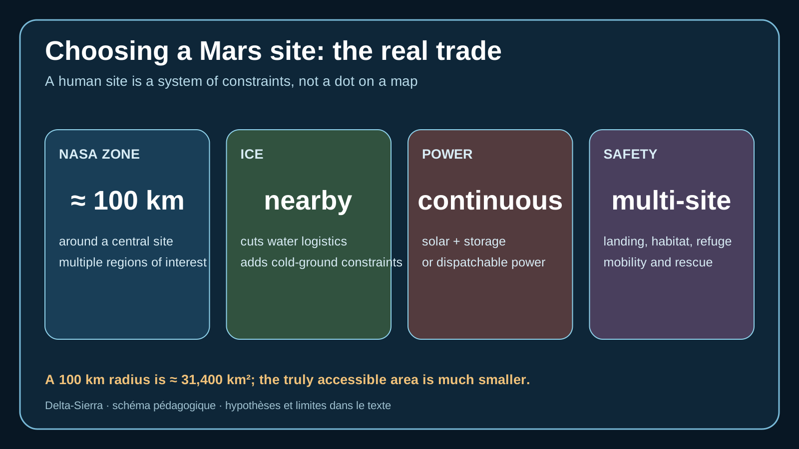
Choosing a Mars site means accepting trade-offs among constraints that do not all favor the same location: landing altitude and safety, resource access, energy, slope, mobility, science and room for expansion. The useful site is therefore not the one that maximizes a single score, but the one whose dependencies remain manageable as the first cargo deliveries become durable infrastructure.
Choosing a site means choosing decades of constraints
“Choosing a site and deploying a Mars base” addresses site selection as a multi-criteria problem connecting EDL safety, resources, energy, mobility and growth.
Scope — the reachable zone around the site, measured resources and infrastructure actually deployable by early cargo missions.
Site selection should be tracked through slope, roughness, accessible ice, illumination, communications, resource distance, landing dispersion and rover routes.
Relationship used here: multi-criteria score = sum of explicitly weighted criteria.
a final site cannot be selected from an attractive image; orbital data, local reconnaissance and mission constraints must be tied together
Deploying the base before it can defend and maintain itself
The most costly site-selection trap is a location rich in one resource but incompatible with safe landing or sustainable surface logistics.
Trading ice, terrain, power, communications, science and safety
gaining local resources without excessive transport distance, EDL risk or maintenance burden
mapping, robotic reconnaissance, precursor campaigns, deployment rehearsals and go/no-go criteria
When a landing site becomes an inhabited geography
Deepening — choosing a site as a multi-decade infrastructure decision
A Mars map is not enough: the decision needs a coupled-constraint matrix
A human site cannot be selected by one spectacular criterion. Accessible ice can reduce water and propellant logistics; low elevation gives an entry vehicle more atmosphere; flat terrain helps landing and roads; latitude affects power and thermal conditions; science may favour geologically diverse terrain. These criteria conflict. A robust process scores candidate zones across multiple indicators, states uncertainty and distinguishes preferences from exclusion criteria.
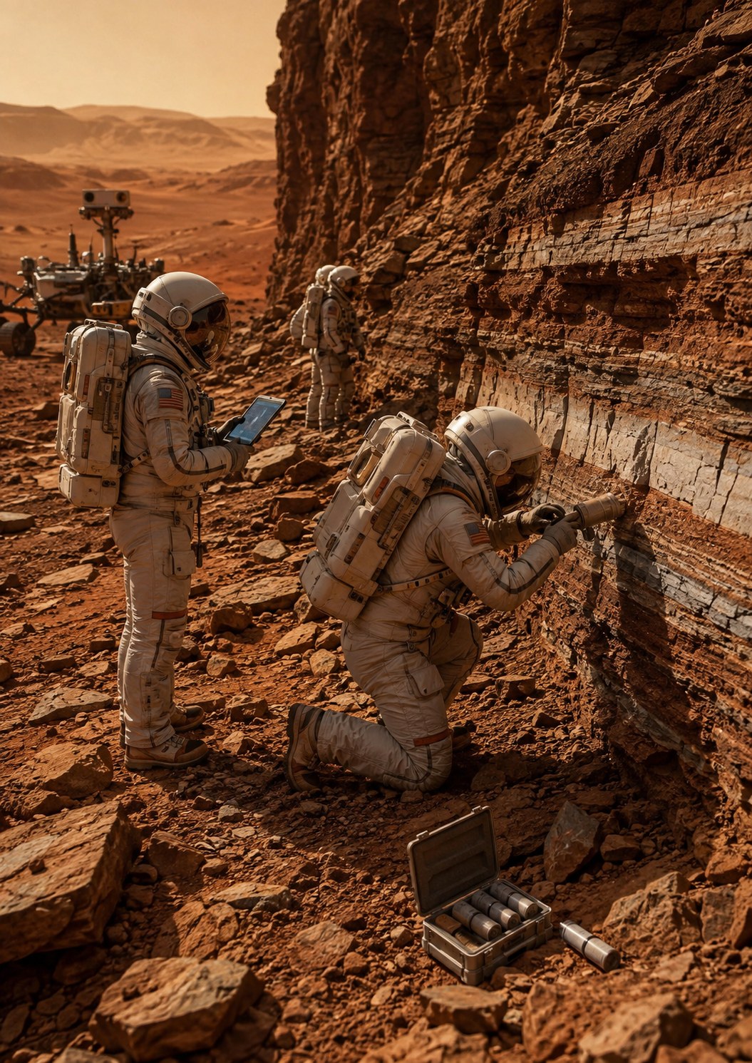
Conceptual site-survey visualization: geology, slope, access, dust, resources and operational constraints must be characterized before freezing the layout of a base.
Some weaknesses can be compensated. A somewhat distant resource can be reached with vehicles. Excessive slope inside a heavy-lander ellipse may be unacceptable. A scientifically exceptional region is not automatically a viable home if it gives heavy vehicles too little atmosphere for deceleration or forces water logistics across hundreds of kilometres. The decision must therefore be architectural rather than touristic.
Orbital data uncertainty also matters. A radar or neutron signature suggesting ice is not equivalent to a drill core demonstrating concentration, depth and mechanical properties. Before committing a crew, robotic reconnaissance should convert critical map assumptions into local measurements: bearing strength, grain size, obstacles, ice, dust, weather, radio propagation and thermal behaviour.
Water is not a blue icon: it is a mining and processing chain
“There is ice” says little about the machines and energy required to use it. Depth, mass fraction, temperature, hardness and salts shape the architecture. Ice 50 centimetres below loose material is very different from a deeper lens under cemented crust. The system has to excavate, transport, heat or sublime, condense, purify, store and maintain every step in the chain.
Distance between resource and habitat becomes a reliability variable. If all water comes from a field 25 kilometres away, rover failures or local weather can become supply events. A settlement can accept that distance only with stock, alternate routes, multiple vehicles and production above average demand. Raw proximity is therefore less important than the ability to build redundant logistics.
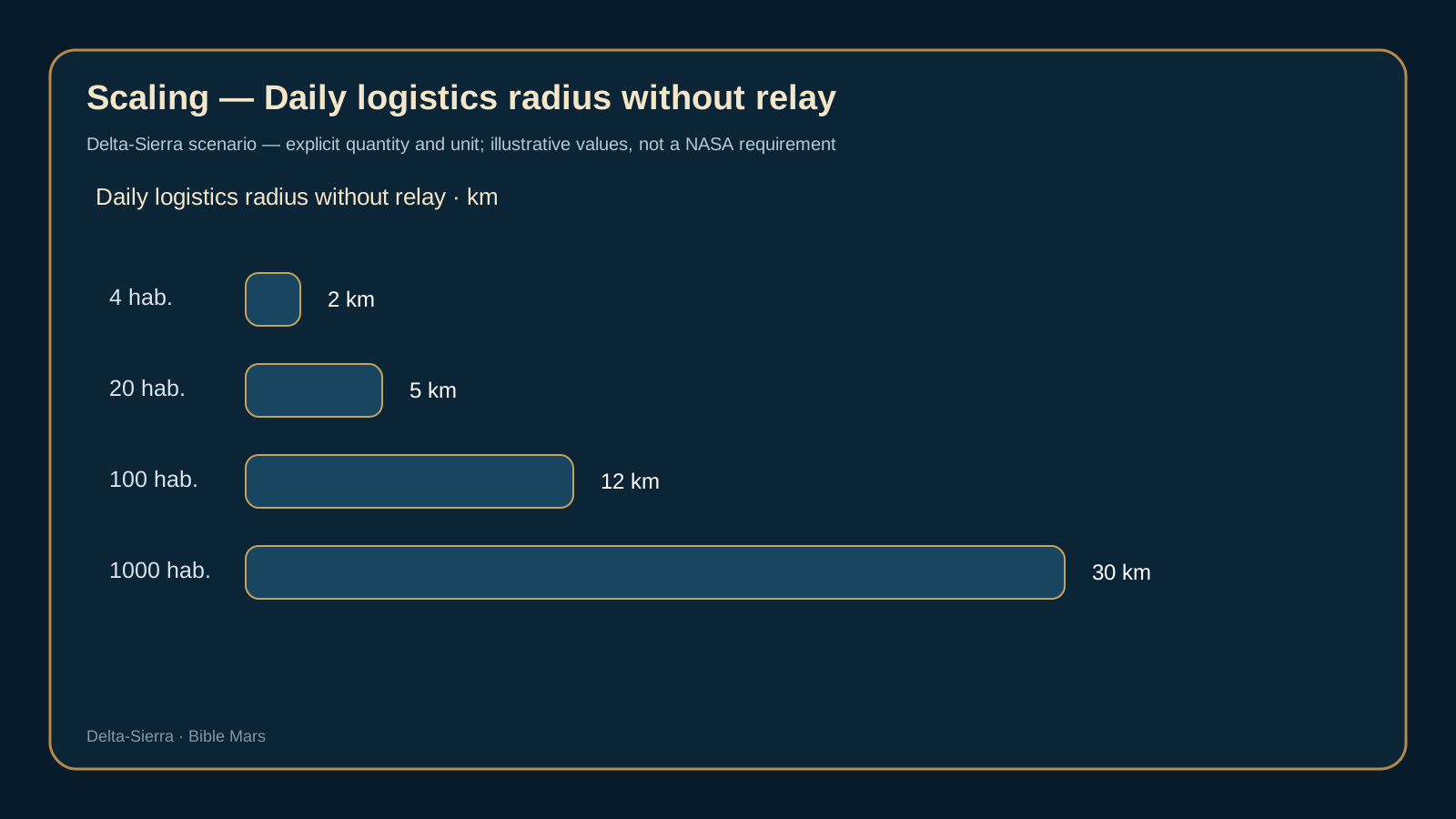
Four residents may operate a demonstrator while relying on imported reserves. Twenty need regular local production. One hundred require an industrial service with maintenance, quality control and storage. One thousand turn water into public infrastructure and feedstock for several industries. The first crew’s site must not trap later growth in an impossible geography.
Separate landing, habitation and industrial zones
A base should not simply grow around the first touchdown point. Heavy landers create plume effects, debris, mechanical hazards and accident zones. Repeated flights need a safety corridor. From the beginning, planners should distinguish landing, habitation, power, storage, industrial, scientific and protected zones while keeping cables, roads and emergency response practical.
This geography changes with traffic. One lander every synodic opportunity tolerates different rules from a Martian port handling multiple cargo vehicles in one campaign. Prepared pads and surfaces then become infrastructure investments that reduce erosion, dust and debris. EDL and urban planning are therefore coupled: landing precision and settlement layout shape one another.
Topography should also protect against future common-cause failures. Putting habitat beside propellant storage shortens pipes but increases shared hazard. Clustering all equipment shortens cables but concentrates risk. A durable site needs enough accessible flat terrain to separate what should be separated without turning every transfer into an expedition.
Power, climate and communications must be evaluated together
Power architecture changes site value. A solar-heavy design cares about seasonal insolation, dust, array orientation and storage. A fission-heavy design relaxes some sunlight constraints but adds deployment, safety and separation requirements. A site ranking derived for one power architecture should not be reused unchanged after the energy concept changes.
Climate also enters through thermal control and maintenance. Colder sites increase heating demand, thermal cycling and potentially soil-mechanics challenges. Dust acts across seals, optics, radiators and solar surfaces. A resource-rich but extreme site can be harder to operate than a more moderate, stable location.
Radio horizon and relay geometry affect operations as well. Broken terrain may require local repeaters or elevated relays. The objective is not permanent direct visibility to Earth; that is unrealistic. It is to design local, orbital and emergency communication paths before the first deployment becomes dependent on them.
Predeploy before people: make the first day a verification, not a gamble
One of the strongest risk-reduction strategies is to land and test critical assets before the crew: power, communications, beacons, stores, construction equipment and perhaps resource production. The key distinction is between “delivered” and “operational.” A generator sitting for a year can age; an antenna can be misaligned; a store can experience unexpected thermal cycles. The crew should not depart on the basis of minimal telemetry.
A human-ready site should expose a readiness state: demonstrated electrical capacity, power margin, stocks, vehicle availability, pressure integrity, consumable quality, communications, local weather and access routes. Every critical dependency needs a response to the loss of one predeployed element. Zero risk is impossible; discovering after landing that several life-critical conditions existed only on paper is avoidable.
Over time the same rule becomes an expansion doctrine. A new district is not habitable merely because its walls exist. It becomes habitable when power, air, water, emergency response, communications and access are proven. Mars thus forces urban planning back to its core: engineering the dependencies that keep people alive.
Selecting not a landing point, but a habitable industrial territory
Turn a site map into a dependency map
A human site cannot be selected with one criterion, even one as important as accessible ice. Altitude, latitude, slope, rocks, dust, temperature, seasonality, solar access, radio visibility, science value, resources and separation between incompatible functions all have to be overlaid. The useful map is therefore more than geology. A location excellent for water but poor for heavy landing can still work if a reliable robotic transport corridor connects the two; a perfect cargo landing zone may be a poor long-term settlement if its terrain constrains power or communications.
This requires a distinction between the landing site and the settlement territory. A Martian town may use separate areas for arrivals, habitation, ice extraction, dusty industry, energy storage, observatories and protected science. Distances between them become mobility, maintenance and emergency-response costs that belong in site selection from the beginning.
Value a resource through its entire extraction chain
Orbital evidence of hydrogen does not equal potable water at a tap. A resource has to be judged through location, depth, concentration, variability, excavation or drilling, transport, processing, energy, purification, storage, quality control and waste handling. Ice two metres below easy material may be more valuable than a richer deposit trapped in difficult ground. A site that cuts extraction energy by 20% can still lose at system level if maintenance travel doubles.
Precursor missions should therefore close uncertainties that actually change decisions. Improving a measurement that cannot alter the architecture is less valuable than constraining ice depth, soil bearing capacity, rock distribution or local dust if those data determine the type of plant, foundation or rover.
Prepare the site before committing the crew
A conservative architecture treats robotic deployment as risk reduction. Cargo missions can map terrain at high resolution, emplace beacons, prepare surfaces, demonstrate power production, deploy relays and begin accumulating consumables. The crew departure criterion should not be “the hardware was launched” but “critical functions have produced Mars data and minimum stocks are physically available.” That turns a sequence of promises into a chain of evidence.
At larger scale, the site also needs expansion reserve. A twenty-person base may remain compact; a thousand residents require safety zones, additional power plants, more traffic, heavy workshops and probably several pressurized districts. Selecting a site without imagining that future footprint risks placing the first Martian city in a logistical dead end.
Deep monograph
Landing is not yet living there: reading terrain before the first cargo
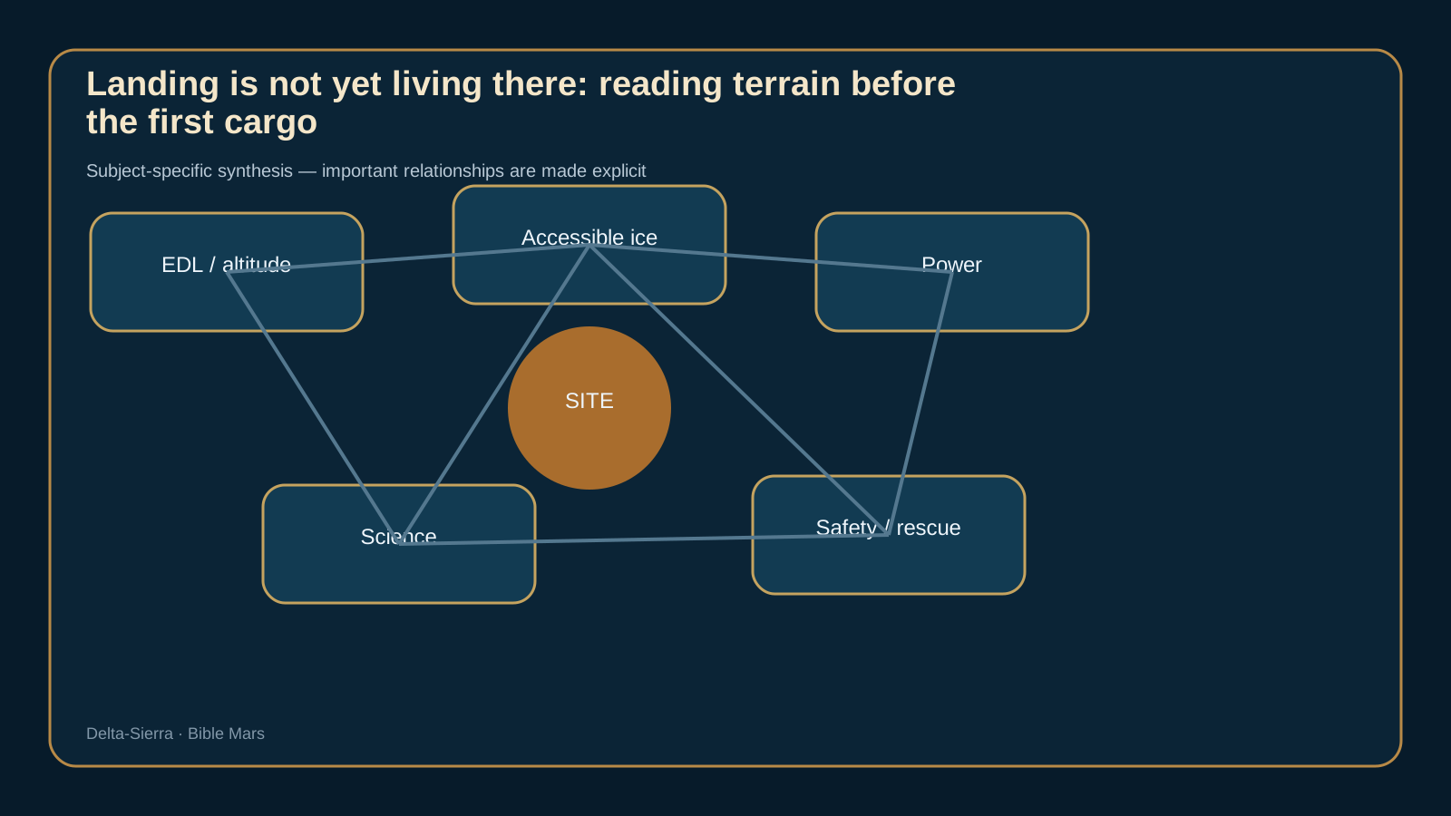
Landing is not yet living there: reading terrain before the first cargo.
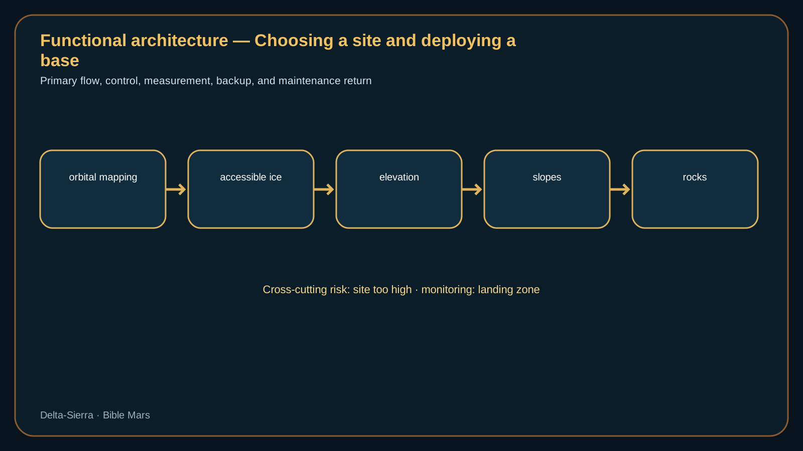
Choosing a site and deploying a Mars base — functional architecture showing the flows, interfaces and dependencies developed in the chapter.Choosing a site and deploying a Mars base — visual synthesis of the system-specific choices and constraints.
A good site must enable survival before it enables science. Diagnosis remains useful only if elevation can still be read during deep dust.
Elevation: more atmosphere for EDL versus other resource constraints
Elevation: more atmosphere for EDL versus other resource constraints. One global readiness label hides those differences.
Elevation: more atmosphere for EDL versus other resource constraints.
Latitude: ice, temperature, solar energy and seasonality.
Ice: likely presence, depth, purity and extractability.
Slopes and rocks: landing safety followed by years of mobility.
Dust: bearing strength, health, seals, visibility and solar energy.
Separating habitat, industry, science and hazardous zones
Science: staying near regions of interest without building the town on the sample.
Landing zone: separating plumes from habitats and equipment.
Power: nuclear, solar, storage and network geometry.
Communications: horizon, relays, Earth visibility and topography.
Industry: separating noise, dust and hazards without absurd logistics.
Reproducible calculations specific to this subject
Exploration-zone area
A = πr² = π × (100 km)² ≈ 31 416 km²
A 100 km radius covers more than thirty-one thousand square kilometres. An exploration “zone” is therefore not a point: distances among ice, science sites, landing corridors and habitat can structure the whole logistics system.
Surface shuttle energy
E = 2 × d × e = 2 × 18 km × 0,55 kWh/km = 19,8 kWh par aller-retour
With ten round trips per day, this consumption assumption gives 198 kWh/day before heating, losses and reserve. An overly dispersed site can therefore turn a geological choice into an energy-infrastructure problem.
Distance compatible with a rescue deadline
d = v × t = 12 km/h × 1,5 h = 18 km
If rescue must reach a crew within ninety minutes and practical average speed is only 12 km/h, the operational radius falls to 18 km. Nominal rover range alone does not define safe geography.
Preparing the site before the crew: reconnaissance and pre-deployment
Agriculture: proximity to water and recoverable heat.
Four people: everything must fit within a very compact operational radius
Four people: everything must fit within a very compact operational radius.
Four people: everything must fit within a very compact operational radius. A useful site-deployment scenario instead asks which environmental constraint is measured, which is inferred from remote sensing, which operating area can be isolated, and which uncertainty would force the landing or habitat plan to change.
Twenty people: first separated zones and rescue routes.
One hundred people: technical urbanism, roads, depots and expansion reserves.
One thousand people: the initial choice becomes a decades-long planning decision.
One thousand people: the initial choice becomes a decades-long planning decision. Recovery case — excessive distance.
Robotic deployment: preparing before humans arrive. Poor bearing strength should be confirmed with independent geotechnical evidence before cargo routes or foundations are committed.
Daily logistics radius without relay — scaling scenario: the quantity and unit are illustrative and are not a NASA requirement.
Four architecture scenarios that materially change the decision
Ice is abundant, but the site is too high
Ice is abundant, but the site is too high. An ice-rich area may be penalized by altitude, atmospheric density, thermal conditions and entry-descent-landing margins. The right answer is not “where the most water is,” but where water, EDL, power, terrain and logistics form a robust compromise. The scenario forces the cost of a resource-rich site that makes every cargo landing harder to be quantified.
The provisional camp becomes a city
The provisional camp becomes a city. The first modules were placed near the landing zone to save time. Ten years later, dust, noise, plumes and heavy traffic make that proximity dangerous. The scenario requires land reserves, corridors, industrial zones and links to be planned during the first campaign so early convenience does not block future growth.
The rescue route becomes impassable
The rescue route becomes impassable. A slope or boulder field that looked acceptable in orbital mapping becomes impassable after local reconnaissance. Geometric distance is no longer the true rescue distance. The site needs alternate routes, relay points and terrain knowledge good enough that the base does not depend on one corridor.
Protecting scientific terrain
Protecting scientific terrain. Industrial expansion threatens to cover or contaminate a geological area intended for long-term science. This is not a secondary conflict: human settlement can destroy the signatures it came to study. The scenario requires protected zones, traffic rules and territorial governance before operational urgency decides everything.
The first base site will decide almost everything that follows
On a map of Mars it is tempting to search for one “best place,” as if choosing a terrestrial building plot. A human base is a different optimization problem. Several landings must be safe; extractable water must be close enough; science targets must justify the mission; terrain must be drivable; power must survive the worst season; hazardous operations need separation; and the site must still make sense when the settlement is ten times larger. NASA’s long-standing Exploration Zone concept captures this systems view: a central landing/habitation area connected to multiple regions of interest, historically within an order of magnitude of about 100 km.
A nominal radius is not a drivable radius: terrain, energy, dust and rescue constraints shrink the usable network.
Geometry gives a useful warning. The area of a circle is A = πr², where A is area, π ≈ 3.1416 and r is radius. At r = 100 km, A ≈ 31,416 km². That sounds enormous, but operational geography is not Euclidean geometry. A steep escarpment, deep sand, a boulder field or a route beyond rescue range can split the apparent circle into isolated islands. Human planners therefore need maps expressed in travel time, energy reserve and recoverability, not merely distance.
Water can reorder every candidate site. Human-exploration studies have emphasized mid-latitude ice-rich ground. One NASA study of a specific candidate found indications of ground ice at roughly 0.15 m depth while screening a 25 km landing ellipse for hazards. That number must not be generalized into “Mars ice is 15 cm deep.” Its value is methodological: orbital signatures, polygons, rocks, cracks, craters and local slopes all have to agree before a settlement can assume that a water mine exists.
The safest place to live may not be the most valuable place to explore. Habitats can occupy a flat, stable sector; power systems can be offset; landing pads can be much farther away to reduce plume and dust exposure; and pressurized mobility can connect the crew to geologically rich terrain. Designing that separation early prevents every future expansion from inheriting the compromises of the first landing.
Power must be evaluated in the worst season. Ice-rich terrain at an unfavorable latitude or under severe dust conditions can demand more storage and dispatchable generation. A sunnier site can impose longer water-haul distances. The correct objective is not maximum sunlight or maximum ice concentration but minimum total risk and imported mass across the full architecture.
A robust campaign should also ask where the second independent base would go. If the first sector suffers a major contamination event, recurring landing hazard, ground instability or power problem, can essential functions be duplicated elsewhere? Thinking about that second site forces designers to treat mobility, communications and logistics as the beginnings of a network rather than accessories to one camp.
Before humans arrive, dedicated robotic precursors should therefore do more than take pictures: test soil mechanics, map ice at excavation scale, dig and process material, characterize dust through seasons, validate routes and rehearse autonomous construction. The best human site is the one that has already started behaving like an industrial site before the crew lands.
Decision scenario: two nearly equal sites. Imagine Site A is closer to extractable ice but requires more winter power, while Site B offers easier power production but adds twenty kilometres of water hauling. Comparing “ice tonnes” with “solar watts” is not enough. Each difference must be translated into machine-hours, wear parts, storage, crew exposure, rescue capability and consequences of failure. A water chain that depends on daily convoys is also a critical mobility chain. A larger power plant may instead serve habitat, mining and industry simultaneously. The ranking changes when coupled functions are counted.
A site should be graded on its ability to absorb the unknown. Soil strength, ice heterogeneity, regional storms and electrostatic dust effects will never be mapped as completely as a terrestrial construction site. Robust layouts therefore preserve options: alternate work areas, spare cable and pipe routes, excavation margin, escape routes and reconfigurable pressurized volume. Margin is not wasted mass; it buys freedom when Mars disagrees with the map.
The first master plan must already contain the future. Habitation, power, workshops, hazardous storage, crops, waste processing, medical capability, cargo arrival and traffic corridors cannot be placed opportunistically. A ten-year expansion should not have to cross contaminated ground or relocate an energy plant that can no longer be isolated. The best first site is therefore one that supports modular growth without blocking the systems that have not yet been built.
The best site is not the place with the maximum value of one resource. It is the place that reduces the combined physical cost of years of power generation, excavation, communications, dust exposure, mobility, ice access, thermal control and terrain risk. A rich deposit that becomes inaccessible in the wrong season can be less useful than a smaller resource embedded in a robust logistics network.
Site selection is therefore a portfolio decision. Robotic precursor campaigns must measure variability, depth, grain properties, slopes, obstacles and routes between regions of interest, not merely confirm that a resource exists. An early site error propagates into cargo mass, power sizing and the layout of every later industrial system.
NASA NTRS — Human Mars Landing Site Selection and Exploration Zones — The Exploration Zone concept shifts from a landing point to an operational territory containing multiple science and resource regions of interest. The page uses it to introduce distance, topography, safety and future growth.
NASA NTRS — Mid-latitude Ice-rich Human Landing Site Candidate — An ice-rich candidate site is used as a case study in the trade among resources, latitude, power, terrain and entry-descent-landing constraints. It is not presented as the selected site for a human mission.
Deciding with incomplete maps and uncertain resources
First 72 hours: power, refuge, communications and inventory first. Even during ice too deep, the crew still needs a trustworthy indication of orbital mapping.
First 30 days: moving from landed to maintainable.
First years: preventing a temporary camp from locking in a bad city.
For a landing zone whose elevation margin is tight, the architecture trade belongs upstream: choose a lower site, carry more entry and landing margin, or accept a smaller landed mass. Surface power can improve recovery after arrival, but it cannot retroactively repair a site-selection error made during entry, descent and landing.
Who may modify orbital mapping?
Choosing under uncertainty: mapping what would change the decision
Choosing under uncertainty: mapping what would change the decision.
Choosing under uncertainty: mapping what would change the decision. Uncertainty — choosing under uncertainty: mapping what would change the decision.
A landing site is a system decision, not a latitude. A location attractive for ice can be poor for landing safety, sunlight, mobility, or communications. A meaningful comparison therefore overlays several maps: EDL safety, slopes and rocks, accessible water resources, seasonal power production, dust, distance between activity zones, and room for expansion. Functional distance matters more than map distance. Two resources separated by thirty kilometres may look “close” on a planetary map while still demanding hours of travel, additional vehicles, spares, and rescue capability. A resilient settlement does not simply search for one perfect point; it looks for a compromise in which no vital function is placed beyond practical reach.
Initial deployment should also preserve options. A landing zone too close to the habitat increases exposure to ejecta and dust; too far away, and every tonne of cargo becomes a surface-transport problem. Power plants, industrial areas, and water storage may benefit from separation because it limits common-cause failures, yet that separation adds cables, pipes, roads, and intervention time. Growth therefore needs to be simulated before the first construction campaign: where can a second habitat go, how would an industrial fire be isolated, which route remains usable after a rover failure, and what part of the settlement survives if one sector becomes inaccessible? Site selection is ultimately a policy of spatial and logistical margins.
Site ranking should also include the cost of being wrong. Some site attributes are recoverable after landing and others are not. A solar array can be expanded, a road can be improved, and storage can be added; an unexpectedly poor landing corridor, inaccessible subsurface ice, or terrain that blocks heavy cargo movement can force a much larger redesign. The reconnaissance campaign should therefore rank uncertainties by reversibility. Orbital data, precursor landers, ground-penetrating measurements, weather observations, and mobility trials are most valuable when they answer questions that would otherwise lock the settlement into an expensive location. This changes site selection from a search for the highest score into a program for retiring the most consequential unknowns.
A final site decision also needs seasonal and failure-state maps, not only annual averages. Solar geometry, atmospheric dust, thermal conditions, communications visibility, and traffic routes can all vary with season or operational state. The settlement should know whether the same corridor used for routine cargo remains usable during a power shortage, whether emergency travel crosses terrain that becomes difficult under low visibility, and whether water extraction can continue when maintenance closes one processing area. Geographic redundancy matters only when the redundant route or resource remains physically reachable during the incident that made it necessary.
Human accessibility should be included in the same map. A geologically attractive site can impose repeated EVA exposure if routine inspection, mining, or maintenance lies outside pressurized mobility range. Conversely, placing every facility close together can concentrate fire, debris, and industrial hazards. The mature layout uses distance deliberately: close enough for logistics, separated enough for hazard isolation, and connected by routes whose rescue time is known under degraded mobility.
Sources and documentary findings
Landing is not yet living there: reading terrain before the first cargo: the references below are retained because they contribute a result, technology status or verification framework directly useful to this subject.
NASA NTRS — Human Mars Landing Site Selection and Exploration Zones
Work on Exploration Zones treats a settlement area as a combination of resources, science objectives and surface capabilities rather than a single landing point. That logic supports territorial planning over tens of kilometres.
NASA/JPL — Follow the Water: future astronaut landing sites
Human landing-site selection strongly trades access to water ice against safety and feasibility. Water is therefore not an isolated criterion: it must be crossed with latitude, terrain, power and arrival constraints.
The physical form of a water resource matters as much as its presence on a map. Accessible ice, diffuse hydrated material, and a deposit requiring deep excavation imply different machines, power levels, production rates, and maintenance burdens; a landing-site trade must compare exploitable resources rather than geological indications alone.
ERNEST's March 2026 desert testing informs site selection through traversability. A base operates across real routes, not a circle on a map: slopes, obstacles, visibility, energy reserve, and recovery time determine whether a resource or science target is operationally reachable even when its straight-line distance looks modest.
NASA's July 2026 studies of advanced robotic Mars mobility strengthen the site-selection argument. A scientifically attractive region can still be operationally poor if crews and robots cannot traverse it reliably; distance, slope, terrain, autonomy, perception, and maintainability therefore belong inside the siting trade.