Course compass
Question directrice : How do coordinates describe position, why do they depend on the chosen frame, and how can convention errors be prevented?
Key idea
Coordinates and reference frames: saying exactly where a rover is. Question directrice : How do coordinates describe position, why do they depend on the chosen frame, and how can convention errors be prevented? The rest of the course turns that idea into an auditable line of reasoning: explicit units, stated assumptions, reproducible calculations, order-of-magnitude checks and interpretation limits. A result is useful only when the reader can explain what it measures, where every input came from and which engineering decision it can support.
Starting synthesis: derivations, examples, limitations and sources are developed in the course body.
Key concepts before you begin
unit · assumption · position · velocity
1 — A coordinate frame is a map with a chosen starting point
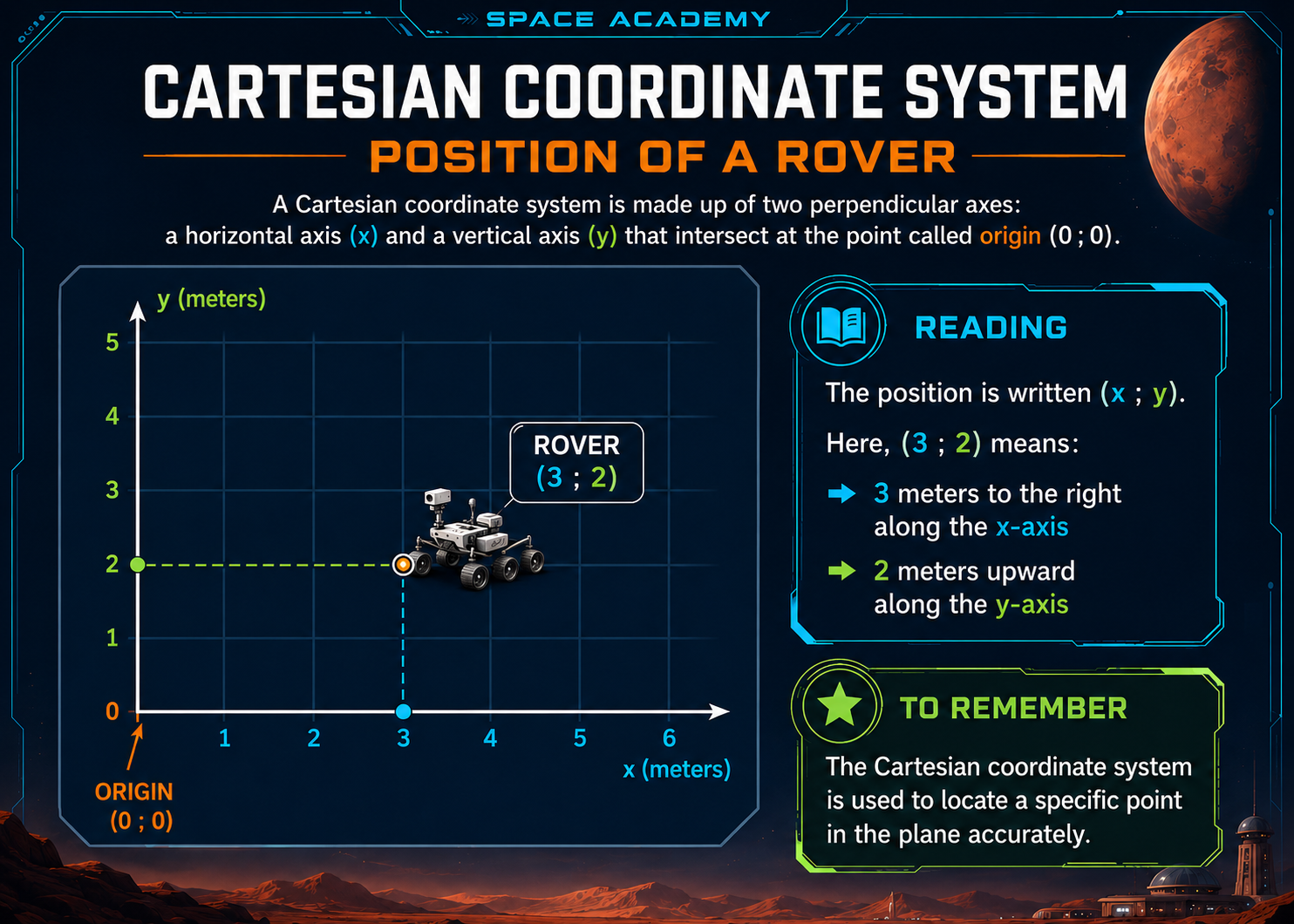
To say where a rover is, “over there” is not enough. We need a shared rule for measuring position.
A coordinate frame specifies an origin, one or more measurement directions called axes, a unit, and a positive direction for each axis.
Origin
The origin is the point assigned position zero, often labelled O. On a local Mars-base map it might be the centre of an airlock, a beacon or a surveyed marker.
2 — What do x, y and the parentheses mean?
In a two-dimensional plane we often use x for horizontal and y for vertical on the map.
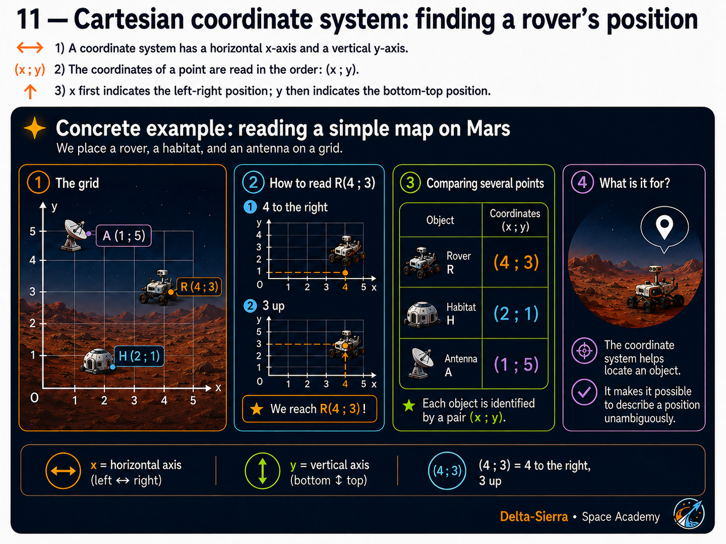
A position such as (4, 3) is read “four, three”. The first number is x; the second is y.
Rover at (4, 3)
If the unit is metres, move 4 m in positive x and 3 m in positive y from the origin. The rover did not necessarily travel along those two legs; coordinates describe its final position.
3 — Why can coordinates be negative?
Plus and minus signs distinguish opposite directions on the same axis. If right is positive x, left is negative x. If north/up on the map is positive y, the other direction is negative y.
Example
(−2, 5) means 2 units in negative x and 5 units in positive y. −2 does not mean an impossible negative distance; it identifies which side of the origin the point lies on.
4 — Concrete example: rover, habitat and antenna
Origin at the habitat. Positive x points east, positive y north. Unit: metre.
- Habitat: (0, 0).
- Antenna: (30, 0) — 30 m east.
- Rover: (30, 40) — 30 m east and 40 m north.
Direct habitat-rover distance
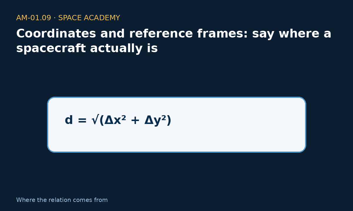
distance = √(30² + 40²) = √2500 = 50 m.
The rover is 50 m from the habitat in a straight line.
5 — Changing the origin changes the numbers, not the physical world
The rover does not move if we decide to measure from the antenna instead of the habitat. Its coordinates change because zero changed.
Same rover, new origin
Old frame: habitat=(0,0), antenna=(30,0), rover=(30,40). New origin at antenna: rover=(0,40). The rover did not move; the measurement convention changed.
6 — Reference frame versus coordinate frame
A coordinate frame is the geometrical tool used to assign coordinates. A reference frame is the viewpoint relative to which motion is described.
Beginner rule: a position or velocity only has meaning when you know what it is measured relative to.
Rover and rescue vehicle
A rover can be stationary relative to the Martian ground but appear to move in a camera mounted on another moving vehicle. Both descriptions can be correct because the reference frames differ.
7 — Adding the third dimension: z
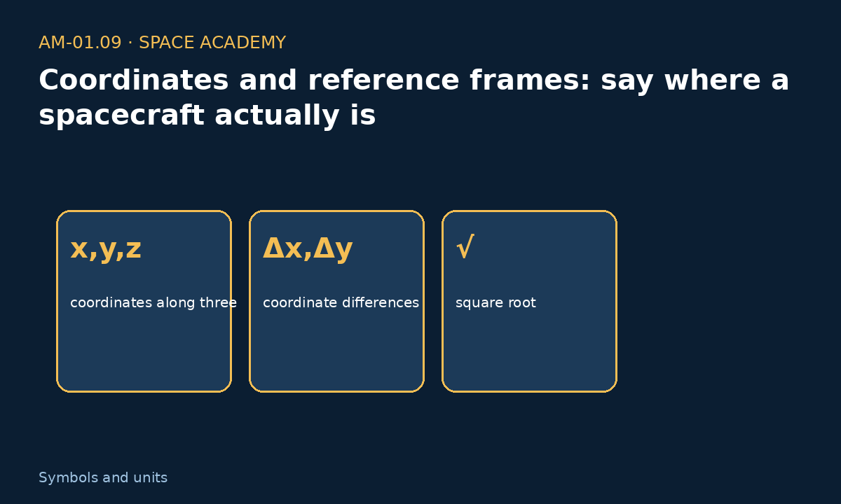
A flat map uses x and y. Add z to describe height or depth. A position (x, y, z) therefore contains three coordinates.
8 — Three complete examples
Example A — Read a position
Origin=habitat. Positive x=east, positive y=north. Rover=(12,−5) m means 12 m east and 5 m south.
Example B — Change from A to B
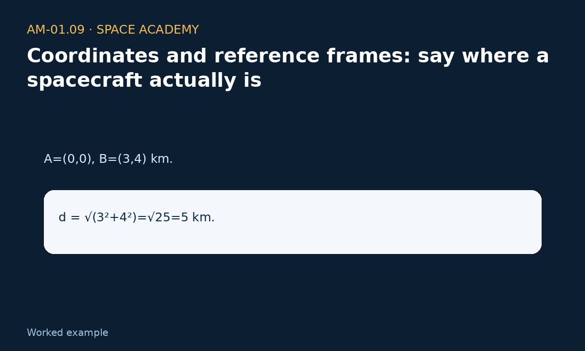
A=(2,3) m; B=(7,11) m. Change in x: 7−2=5 m. Change in y: 11−3=8 m.
Example C — New origin
Beacon=(100,20) m; rover=(130,50) m. Relative to the beacon: x=30 m, y=30 m, so rover=(30,30) m.
9 — Local and geographic coordinates answer different questions
x-y-z coordinates can be convenient around a base. Across a planet, geographic systems such as latitude and longitude are more suitable and follow their own conventions.
A navigation system must clearly state which coordinate system it uses. Mixing two systems can create a major error even when each number looks reasonable.
10 — Five questions before a coordinate calculation
- Where is the origin?
- Which way does each axis point?
- What unit is used?
- Is the model 2D or 3D?
- Relative to which reference frame is motion described?

Exercises and answers
Exercise 1
Positive x=east, positive y=north. Translate (−4,9) m.
Exercise 2
A=(1,2), B=(6,5). Find changes in x and y.
Exercise 3
Why can a rover's coordinates change while it does not move?